Drone Services for Construction

Cut delays and rework with precise aerial data from progress tracking to 3D mapping and structural inspections.

Construction Progress Documentation

Why Use Drones in Construction

Aerial insights that move your projects forward

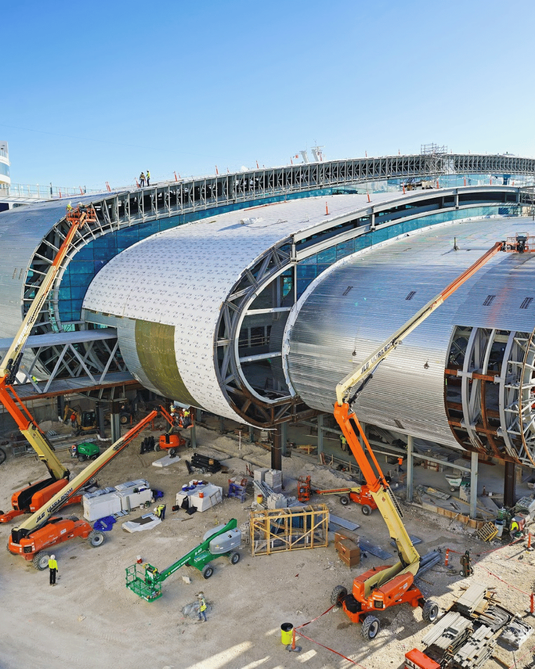
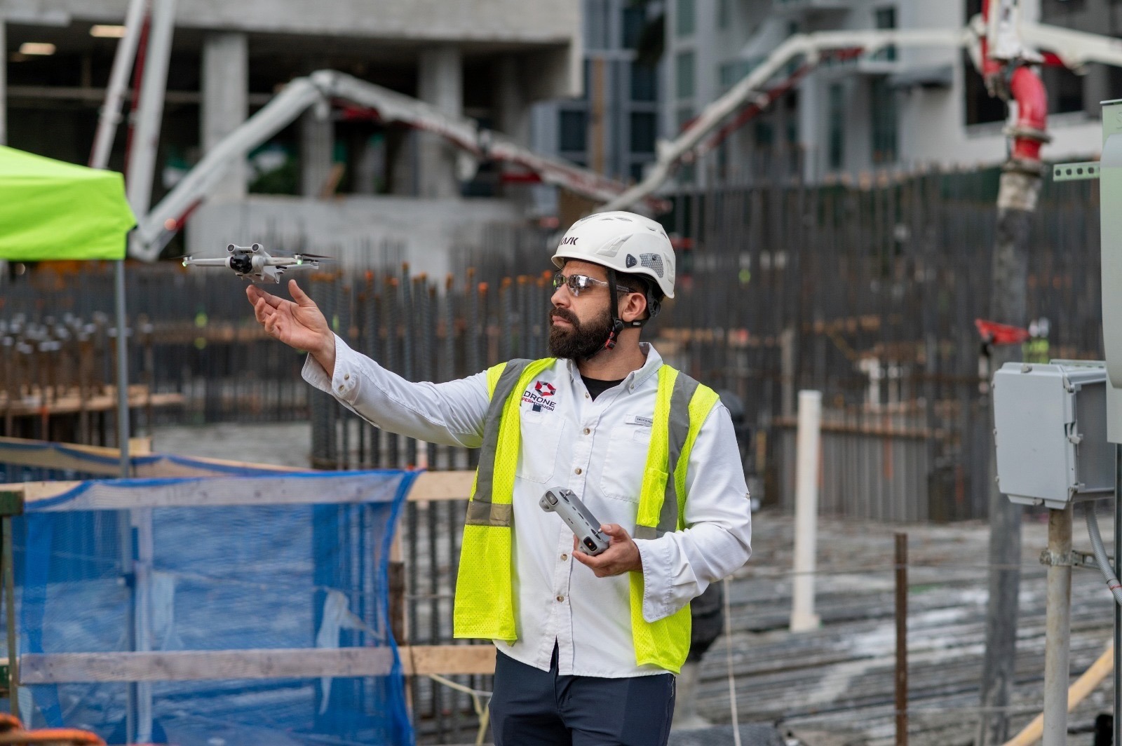
Modern construction sites generate massive complexity. Drone mapping and progress monitoring simplify oversight, giving you real-time visibility without stepping on-site.

Benefits include:

  • Stay on schedule: Monitor work weekly or biweekly with consistent vantage points.

  • Reduce rework: Detect issues early by overlaying as-built imagery with CAD or BIM models.

  • Improve safety: Inspect roofs, facades, and tall structures without exposing crews to hazards.

  • Prove progress: Provide owners, lenders, and stakeholders with timestamped documentation.

Drone Services for the Construction Industry

Whether it’s aerial photography or videography, it can be applied in a wide range of fields and for various purposes. 

Deliverables You Receive

Each mission includes standardized, professional outputs ready for your workflow:

  • Orthomosaic (GeoTIFF) – Georeferenced high-resolution aerial map.

  • 3D Model (OBJ/FBX) – Visualize and measure site conditions in 3D.

  • Point Cloud (LAS/LAZ) – Detailed spatial data for CAD/BIM integration.

  • Contour Files (DXF) – Ready for engineering design overlays.

  • Volume Report (CSV/PDF) – Quantified material calculations.

  • Photo Set (JPEGs) – Organized imagery with EXIF and GPS data.

  • Web Viewer Link – Easily share deliverables with your team and clients.

How It Works

A simple 3-step process

1. Scope & Quote

Share your site boundary (KML, shapefile, or address), desired accuracy, and schedule. We’ll recommend the right package.

2. Flight & QC

Our FAA-certified pilot executes the mission following pre-approved flight plans. All imagery is reviewed for quality and accuracy.

3. Delivery

Receive your deliverables via secure cloud link within 2-5 business days, depending on project scale.

Drone Pilot Doing Drone Mapping

Why Constructers Choose Us

  • Certified Expertise: FAA Part 107 licensed, insured pilots across the country.
  • Fast Turnaround: 2–5 business day delivery for most missions.
  • Accuracy You Can Trust: Ground control integration for survey-grade data.
  • Safety First: We manage all airspace permissions and safety protocols.
  • Secure Delivery: Encrypted cloud links, access-controlled sharing.

Professional Drone Pilot in Florida

Industries & Applications

  • General Contractors
  • Developers & Owners
  • Civil Engineering Firms
  • EPC & Infrastructure
  • Utilities and Energy Projects
  • Logistics Parks & Industrial Facilities

Frequently Asked Questions

Depending on altitude and GCPs, we achieve 2–5 cm/pixel accuracy comparable to traditional surveying for most construction tasks.

Yes, our pilots handle LAANC authorizations and waivers for controlled zones.

We reschedule at no cost to maintain data quality and flight safety.

Absolutely. Deliverables are compatible with CAD, GIS, and BIM platforms.

Yes. We can automate recurring schedules for weekly or monthly progress tracking.

Scroll to Top