Drone mapping in Florida typically costs $500–$2,500 per project for small-to-mid sites, or $1,000–$3,000 per month for recurring construction progress mapping. Large or LiDAR projects can run higher. The exact price depends on three things: site size, the accuracy tier you need, and the deliverables you order. Flight time has surprisingly little to do with it.
If you’ve collected quotes already, you’ve probably noticed they’re all over the place. One provider says $200 and another says $2,500 for what sounds like the same map. This guide explains what the market actually charges in 2026, why quotes vary so much, and how to tell whether you’re buying pretty pictures or reliable data.
Key Takeaways
- Typical project cost: $500–$2,500 for most Florida sites under 100 acres. Full-day photogrammetry engagements run around $1,500–$2,500 per day including processing.
- Recurring construction mapping: $1,000–$3,000 per month is the common range for a mid-size site.
- Drone vs traditional survey: for a 50-acre topographic job, drone mapping typically costs $800–$2,000 and takes hours. A traditional crew costs $3,500–$7,000 or more and takes days.
- Accuracy: 1–3 cm is achievable with RTK drones plus ground control points (GCPs). RTK alone gives good relative accuracy; GCPs are what make accuracy provable.
- Legal limits: a drone map is not a boundary survey. Property lines always require a licensed land surveyor. Drone data is valid and widely used for progress tracking, stockpile volumes, as-builts, and pre-design topo support.
How much does drone mapping cost per project?
Most drone mapping projects in Florida fall between $500 and $2,500. Small single-visit sites like stockyards or lots under 20 acres sit at the low end, while multi-deliverable jobs with survey-grade control sit at the top. Per-day pricing for UAV photogrammetry, including basic processing and deliverables, commonly runs $1,500–$2,500.
| Service | Typical 2026 price range | Notes |
|---|---|---|
| Small site map (under ~20 acres) | $500 – $1,200 | Orthomosaic + basic measurements |
| Mid-size site (20–100 acres) | $1,200 – $2,500 | Add GCPs for provable accuracy |
| Full-day photogrammetry | $1,500 – $2,500 / day | Includes processing + deliverables |
| Stockpile volume report | $500 – $1,500 per visit | Priced per site + number of piles |
| LiDAR mapping | 2–3× photogrammetry cost | Needed for vegetated/complex terrain |
| Monthly construction progress mapping | $1,000 – $3,000 / month | Recurring flights + updated deliverables |
A quick warning about the “per acre” prices you’ll find online: published guides contradict each other wildly. Some quote $5–$20 per acre, others $150–$300 per acre. That’s because per-acre pricing breaks down in practice. Professional operators price per project, based on deliverables, accuracy requirements, processing time and travel, not raw acreage. If a quote is priced strictly per acre and nobody asked you about deliverables, treat that as a red flag.
Why do drone mapping quotes vary so much?
Two quotes for “the same site” can differ by 5–10× because you’re not buying the flight. You’re buying the data pipeline behind it, and the flight is often the cheapest part of the job. What actually moves the price is accuracy tier, sensor, processing hours, and whether the results can be verified.
- Accuracy tier. A marketing-grade map and a survey-support-grade map require different equipment, ground control, and QA. Provable accuracy costs more, and it’s worth it when real decisions depend on the numbers.
- Sensor. Standard photogrammetry vs LiDAR. LiDAR penetrates vegetation and costs 2–3× more.
- Processing time. Turning hundreds of photos into an orthomosaic, point cloud, and volume reports takes real engineering hours that clients never see. This is the invisible cost behind serious quotes.
- Ground control. Setting and surveying GCPs adds field time, but it’s what makes the map’s accuracy independently checkable.
- Airspace. Sites near MIA, MCO or TPA require LAANC authorizations or FAA waivers. Experienced operators handle this routinely; hobbyists can’t.
Drone survey vs traditional land survey: which is cheaper and faster?
For topographic data collection, drone mapping is typically 3–5× cheaper and 10× faster than a conventional crew. On a 50-acre site, a drone survey runs about $800–$2,000 and is flown in hours. A traditional ground crew runs $3,500–$7,000 or more and spends days on site.
| Drone mapping | Traditional survey crew | |
|---|---|---|
| Cost (≈50-acre topo) | $800 – $2,000 | $3,500 – $7,000+ |
| Field time | 1–4 hours | 2–5 days |
| Data density | Millions of points | Hundreds of shots |
| Boundary/legal work | ❌ Not valid alone | ✅ Licensed surveyor |
| Best for | Progress, volumes, topo support, as-builts | Boundaries, certifications, legal filings |
Here’s the honest answer, and it’s one professional surveyors insist on: these are complements, not substitutes. Drones win on speed, cost, and data density for surface features. Licensed surveyors remain mandatory for anything involving boundaries or certified documents. The best workflow on Florida construction projects combines both, using drone data for frequency and coverage while the surveyor of record handles control and certification.
How accurate is drone mapping? (RTK vs GCPs, explained simply)
Modern drone mapping achieves 1–3 cm accuracy when an RTK-equipped drone is combined with surveyed ground control points. RTK alone typically delivers good relative accuracy, meaning measurements within the map are consistent. GCPs anchor the map to real-world coordinates and make the accuracy provable.
Here’s the plain-English version of a debate that fills mapping forums:
- RTK drone, no GCPs: the map is internally consistent, so distances and volumes within it are reliable, but you’re trusting the drone’s word for absolute position. As one surveyor put it: “you can’t prove it to a client without ground control.”
- RTK + GCPs (checkpoints): independent surveyed points let anyone verify the map’s error. This is what “survey-grade” actually means in practice.
At Drone Permission we place ground control on any project where the client’s decisions depend on the numbers: volumes, grading verification, pre-design topo. That way the accuracy can be audited by your engineer or surveyor instead of just claimed by us.
Can a drone map be used for property lines? Is it legally valid?
No. A drone map by itself is never a legal boundary survey. Property lines, plats, and certified surveys require a licensed land surveyor in Florida and every other US state, and there have been lawsuits against drone operators for unlicensed surveying. What drone data is valid for: construction progress documentation, stockpile volumes, as-built verification, and topographic data delivered to your engineer or surveyor of record.
Think of it as a division of labor:
- Drone data is appropriate for: progress tracking and documentation, earthwork and stockpile volumes, site planning and design support, marketing, inspection, and as-built comparison against plans.
- A licensed surveyor is required for: boundary determination, certified topographic surveys, plats, elevation certificates, and anything filed with a court or government agency.
A professional drone provider will tell you this upfront, and will happily deliver data to your surveyor or civil engineer rather than pretending to replace them.
What deliverables do you actually get from a drone mapping project?
A standard drone mapping package includes an orthomosaic (a measurable, high-resolution aerial map), a 3D point cloud, elevation models (DSM/DTM), and, when ordered, stockpile volume reports and progress comparison sets. Always confirm deliverables and file formats in writing before comparing quotes.
In plain terms:
- Orthomosaic: one giant, distortion-corrected aerial image you can measure on. Like Google Maps, but centimeter-level and from this morning.
- Point cloud: millions of 3D points representing the site surface. This is what your engineer imports into Civil 3D.
- DSM/DTM: elevation models with structures and vegetation included (DSM) or stripped to bare earth (DTM).
- Volume reports: stockpile and cut/fill quantities, typically accurate within 1–2% with proper control.
- Progress sets: time-stamped flights over the same flight plan, so week 12 overlays perfectly on week 2.
This is also why quotes vary so much: a provider quoting $400 is usually delivering photos, not this data stack.
How often should a construction site be mapped, and what does it cost monthly?
Most Florida construction projects fly monthly progress mapping, moving to weekly or biweekly during earthwork and vertical milestones. Recurring programs typically cost $1,000–$3,000 per month for a mid-size site, which is a fraction of what a single scheduling dispute or pay-application disagreement costs.
The cadence that works on real projects:
- Earthwork phase: weekly or biweekly. Volumes change fast, and this is where mapping pays for itself.
- Vertical construction: monthly mapping plus photo and video documentation of milestones.
- Closeout: a final as-built flight against design surfaces.
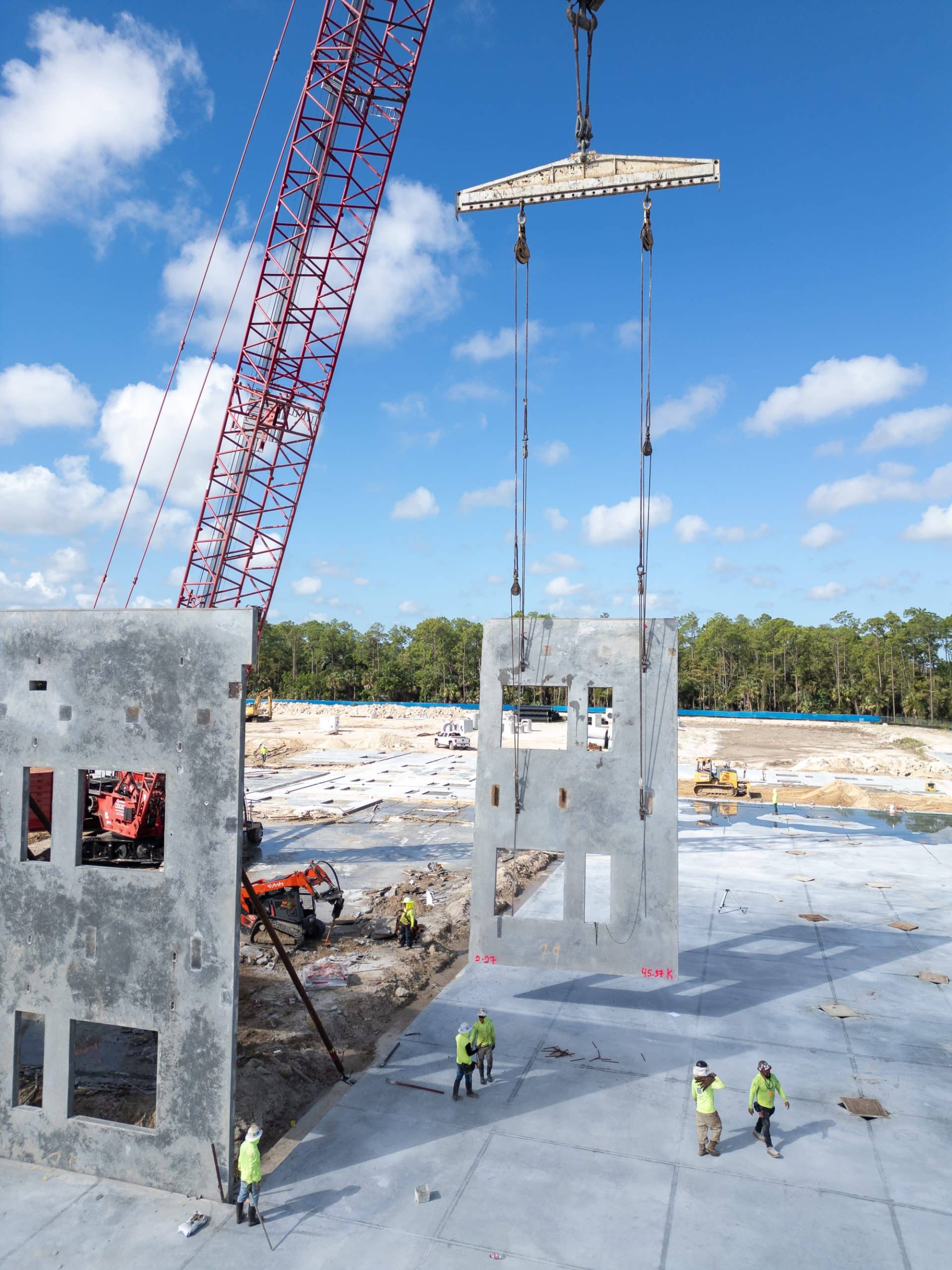
The two panoramas below are the same resort development, flown nine months apart on the same flight plan. This is what consistent, comparable progress documentation looks like:
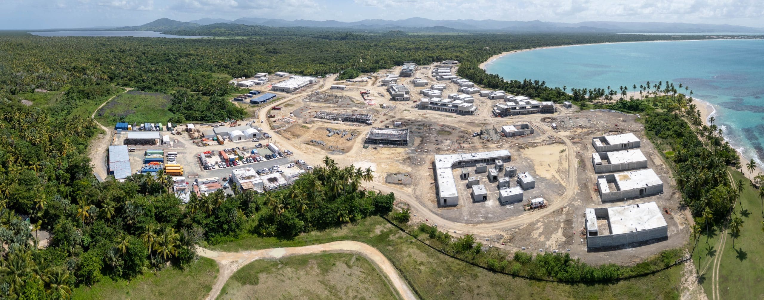
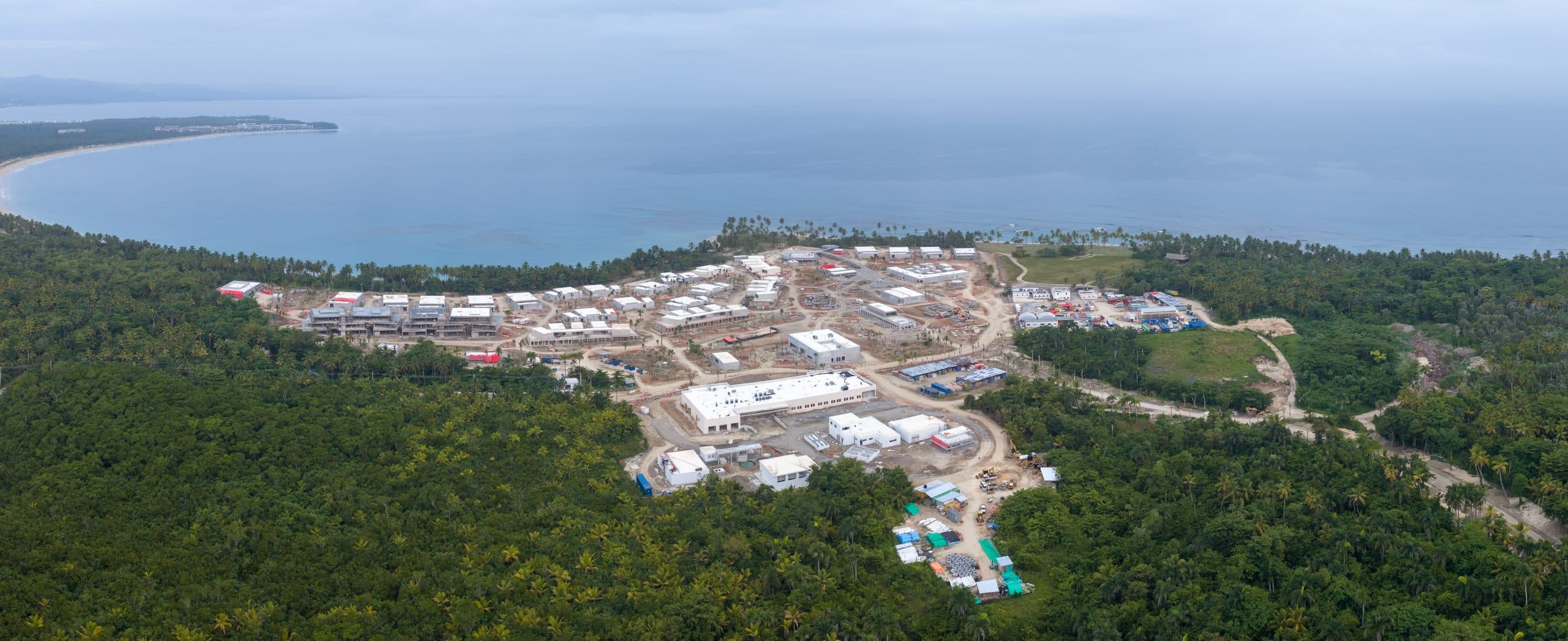
We’ve documented some of Miami’s most demanding vertical projects on recurring flight programs, including Aston Martin Residences and the Waldorf Astoria Miami, so lenders, owners and GCs get consistent, comparable data instead of one-off snapshots. See our construction drone services and our guide to construction progress monitoring with drones.
FAQ
How much does drone mapping cost per acre?
Per-acre pricing is unreliable. Published rates range from $5 to $300 per acre because acreage isn’t the real cost driver. Expect project-based pricing instead: roughly $500–$1,200 for small sites, $1,200–$2,500 for mid-size sites, and more for LiDAR or survey-grade control.
How accurate are drone stockpile volume measurements?
With proper flight planning and ground control, volume measurements typically land within 1–2% of ground-truth. That’s accurate enough for inventory reporting and pay applications, at a fraction of the cost of ground crews climbing piles.
Photogrammetry or LiDAR: which one do I need?
Photogrammetry (camera-based) covers most construction and open-terrain sites at the best price. LiDAR costs 2–3× more and earns it only when you need ground data under vegetation or in complex vertical environments.
Can you fly near Miami, Orlando or Tampa airports?
Yes. Much of urban Florida sits in controlled airspace around MIA, MCO and TPA. Licensed operators obtain LAANC authorization, often instantly, or FAA waivers for restricted zones. This is a key reason to hire FAA Part 107 certified pilots rather than “a guy with a drone.”
How fast do I get deliverables?
Typical turnaround is 24–72 hours after the flight for orthomosaics and volume reports, depending on site size and deliverables. Rush processing is available for pay-application deadlines.
Does weather affect scheduling in Florida?
Summer storms can shift flight windows, but mapping flights are short (often under an hour of flying) and reschedule easily. Recurring programs build weather buffers into the calendar so monthly datasets stay consistent.
Get a Florida drone mapping quote with defined deliverables
Drone Permission is an FAA Part 107 certified drone services team covering Miami, Orlando and Tampa, with recurring mapping and documentation programs on projects like Aston Martin Residences, Waldorf Astoria Miami and Una Residences. Every quote specifies deliverables, accuracy tier and turnaround in writing, so you can compare it fairly against any other bid.
Request a mapping quote → or explore our drone mapping services, Miami drone mapping and Tampa drone mapping.